Tips and Reviews
Tourney Prep: Charts
If you’re like most bass fisherman, trying to come up with the winning pattern for an upcoming tournament can be the most overwhelming part of being a competitive angler. Here’s some tips to break down how to make the most of the time you have to get ready for the big event.
Before you get to the lake
The most efficient thing you can do with your practice time is making decisions well in advance using your computer. These days we have everything at our fingertips with the internet resources available on all of our many devices. Use them! Here are the steps most professional and amateur level anglers are using before they head to the lake.
Paper Lake Charts
First thing you can do is order a quality paper chart from the many online retailers selling them. You can do this months in advance, you will be giving time for shipping at a minimum. Check as many resources as you can, and if possible get recommendations and read reviews. You can also buy these locally at tackle shops, but that won’t help you with and event 500 miles away. Keep in mind that not all paper charts are created equal, in fact some are complete garbage. You want a paper chart that will give you some important information such as:
- Navigational Hazards
- Fishing Hot Spots
- Species Information
- Submerged Cover Details - grass types, stumps, flooded trees etc.Public Boat Access Areas
Some of these maps may have some fishing report data as well, but make sure you note when this information was updated, if at all. However, sometimes older information is still valid today, and maybe you can take what strengths you have as an angler, and adapt to those reports to fine tune your game plan.
Digital Lake Charts
Now on to the more nerdy, technical side of practice, online charts. There are 2 main websites that provide free access to lake charts and both have their pros and cons. The first one I will cover is the well known Navionics web app, and the Navionics phone app. Both of the Navionics options are free, with a paid option for additional features, but for the most part we can get all we need using the free versions.
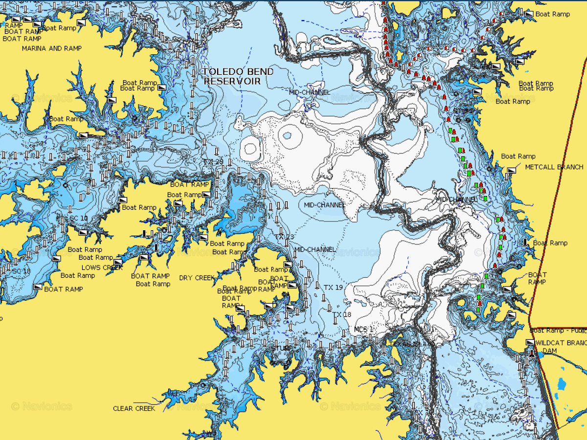
Most of the lake charts in the Navionics apps are fairly accurate, and if you select the “Sonar Chart” option on these you will get maps with data received from actual sonar data sent in by users of popular modern sonar systems. The normal charts are mainly based of government data, and not nearly as detailed as the additional data that has been pouring in from these units.
Now you have a complete view, including some basic information on flooded timber, submerged grass, road beds, and the like. The only issue with the information in the web app data is that most is vague, or not recently verified. Boat Launches you will see all over the maps, but that doesn’t mean they are public, have parking lots, or are even real functional boat access areas. In order to transfer this data to the unit on your boat, you’re going to need to buy the products, they have numerous options available.
Pros to Navionics
- Large Database of complete maps
- Sonar Chart has more detail with higher accuracy
- Web App has settings you can adjust
- Depicts areas with road beds, submerged items and hazards
- Premium versions available on memory cards
Cons to Navionics
- Free version limited to smart phones and computers
The second option is using C-Map Genesis, a Lowrance, Simrad Yachting and B&G user fed system of shared maps. Newer models of the Lowrance and other devices are possible making this obsolete however, with the addition od realtime map creation on some models. The C-Map Genesis maps are generated completely by the data from Lawrence users that have “Logged” their sonar on trips to the lake and then in turn uploaded them to the C-Map Genesis website for public consumption. This data is fairly reliable, although charts created on lakes that have fluctuating water levels you will have to be weary of. Was the lake up when logged or low? Could be important if the lake drops 5-10’ below full pool!
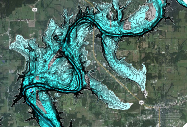
The benefit of these “Social Maps” is that anyone with a Lowrance (not sure if this works on other units at the time of this writing) can generate and download maps with this data to install into their unit for use on the water. This part of the service is free, which is grate. The pay option available at C-Map Genesis allows you to take your data, upload it and keep it private. So you can map your local lake, and keep all that data to yourself.
Pros to C-Map
- Free versions can be downloaded for your chart unit
- User fed system that you can keep private or share
- You can determine what the popular parts of the lakes are (Incomplete maps can be interpreted this way)
Cons to C-Map
- Only shows depth contours, no road bed, submerged item information added
- Incomplete maps on most lakes (also see Pros..)
There you have it, some chart options that will allow you to get a look at the lake before ever leaving your house! Next we will cover the other things you can do before loading up for the trip that will have you feeling like you’re one of the locals!
Comments
Be the first to comment on this article!